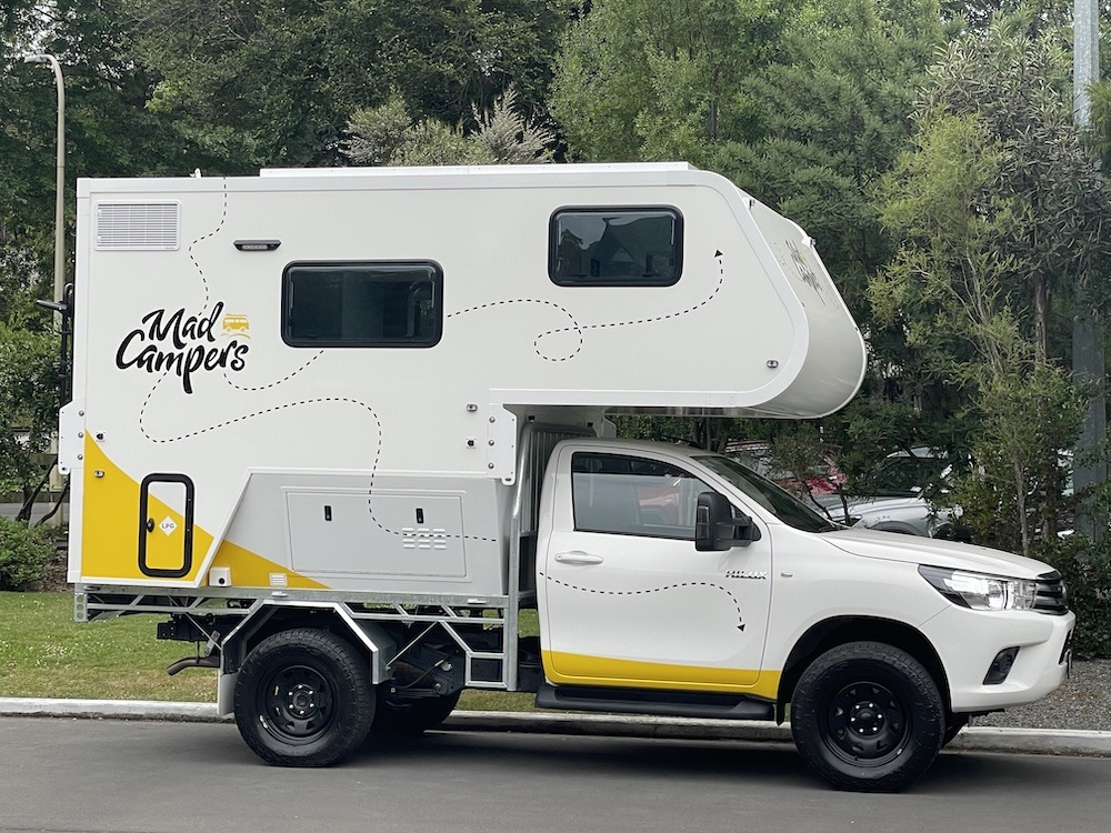
Today is Sunday, and I went for another ride over the mountains but this time I descended the other side to checkout the small towns on the bay. Before I left the hotel parking lot I saw a rugged looking camper built on a Toyota chassis. I guess the occupants needed a real bed and shower for the night 🙂
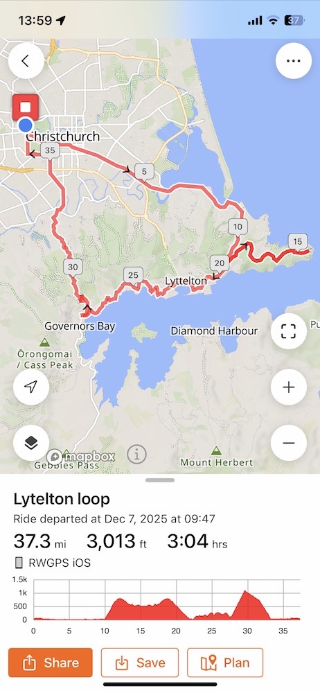
The route starts off the same way as day 2, heading directly for Sumner via the coastal bike path before the big climb up Evans Pass Rd. At the summit, or shall we call it the Col de Evans Pass, instead of going right on Summit Rd I went left for an out & back ride to the ocean. Then retracing my route back to the Col de Evans Pass and taking a left for the first time down the incredible descent into Lyttelton. The bay road heading west has a few ups and downs but nothing too big before ending at Dyers Pass Rd. Here you go right and dig in for the long and steep climb to the Col de Dyers Pass. Finally, descending the fast Dyers Pass into Cashmere and on into Christchurch.
The route to Sumner is becoming familiar to me and I am riding like a local 🙂 As I was rolling through Sumner an odd sight caught my eye and I had to look twice to believe my eyes! A lady was walking her hog (without a leash) across the zebra crossing, and he/she was following the lady like a well-trained dog! I have a video of this and extracted this image to include in the blog. If you have the link to my unedited videos then you can find it in the day 5 sub-folder.
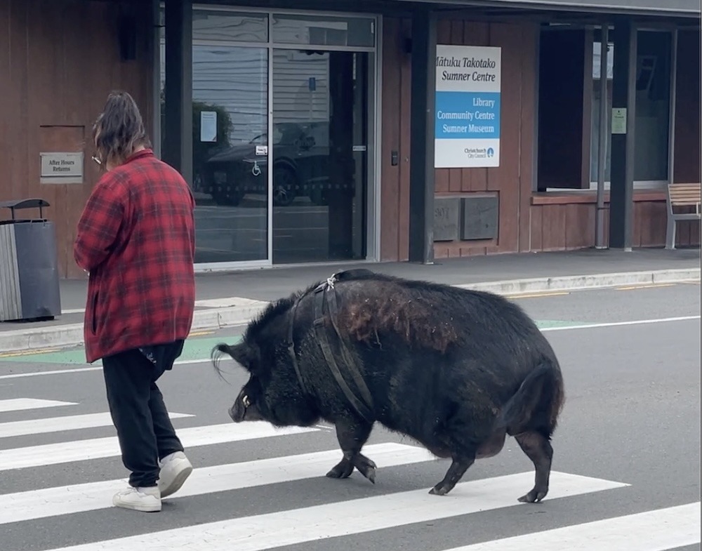
Another local lady walking her dog told me that the hog lives locally and he’s a bit of a celebrity, everyone loves him. Before he crossed, I don’t think he wanted to go as that path takes him back home. He was grunting at the owner who was calmly talking to him about why they needed to go across the road! Seriously, I can’t make this stuff up 🙂
Soon the memory “Hog” was crowded out by the long slog of a climb up to the Col de Evans Pass, it seems to be mostly 9% on the lower part but quickly ups the ante to 11%, 12%, 13%, and I think I briefly saw 14% on the Garmin. You wouldn’t think a few % would make that much difference… but it did! I was carrying a backpack (on all these rides actually) with food, rain gear, portable battery bank etc, so I wasn’t as light as I could be 🙂
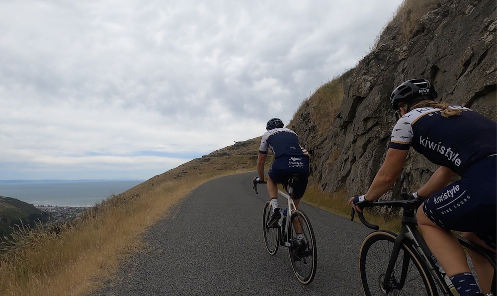
Turning left at the top of the climb, takes you up some more as you head east on the Summit Rd. A couple of cyclists came by but didn’t stop for a chat! Clearly on a mission to get to the top quickly.
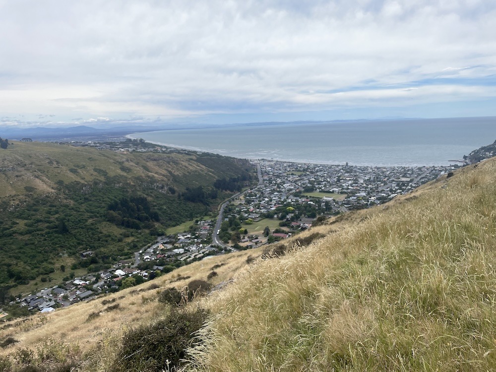
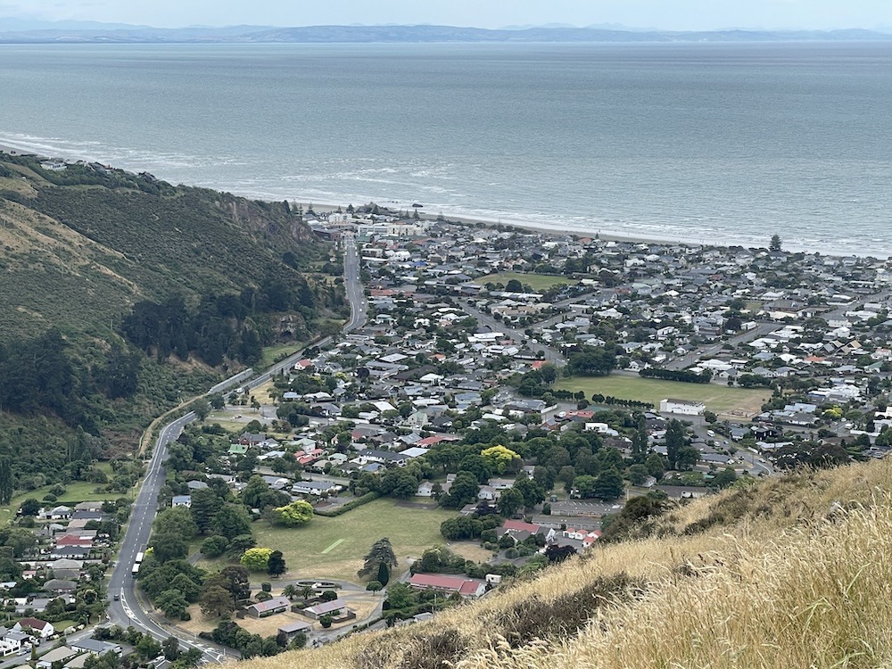
This is the first time I rode this part of the road and it revealed some new angles on the coastal headlands between me and Christchurch.
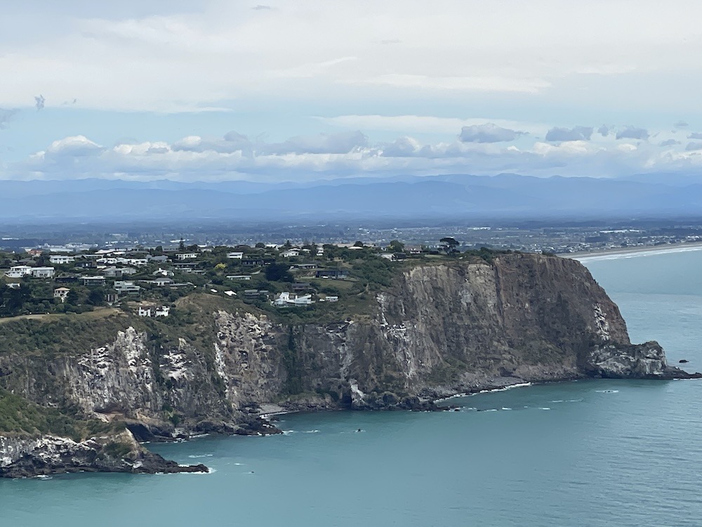
Once I arrived at the end of the road, I found a campsite area which is an awesome place to hang out, but it would be a bit windy for a tent. A camper van or staying in one of their buildings may be the way to go. After a snack, I retraced my route back to the Col de Evans Pass where I turned left to head down a crazy long descent into Lyttelton at sea level. I was pedaling like a mad man down the hill and was beating a motorcycle through the corners, I eventually let him pass and he politely acknowledged that 🙂
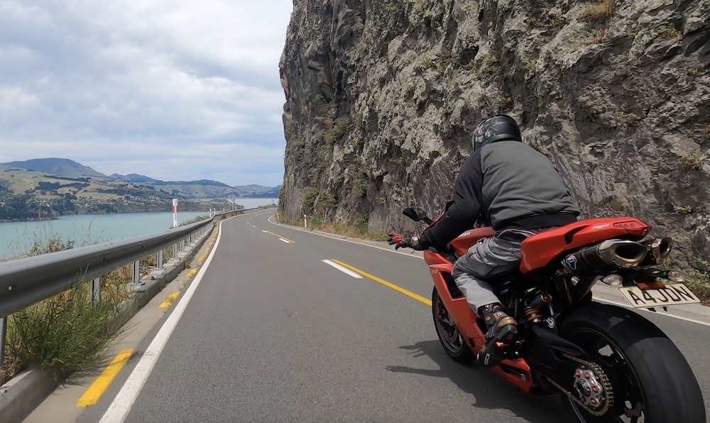
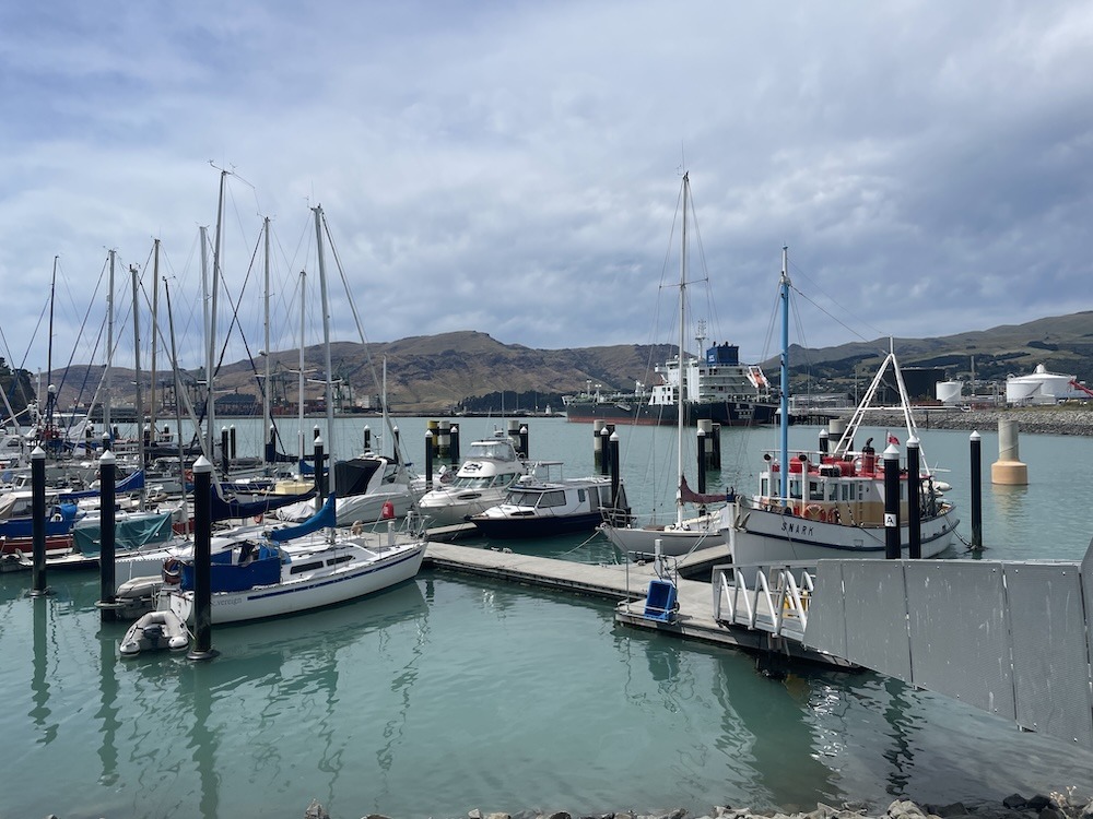
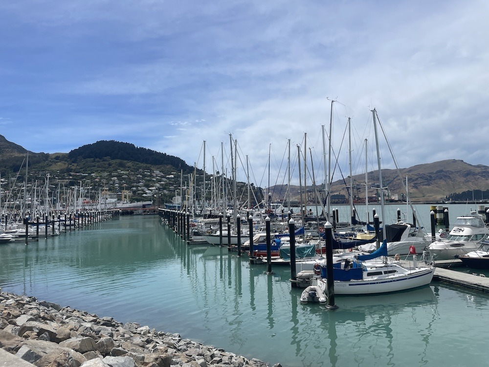
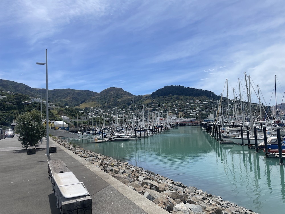
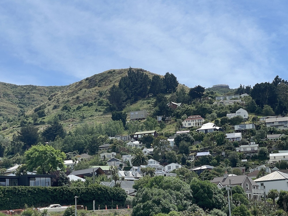
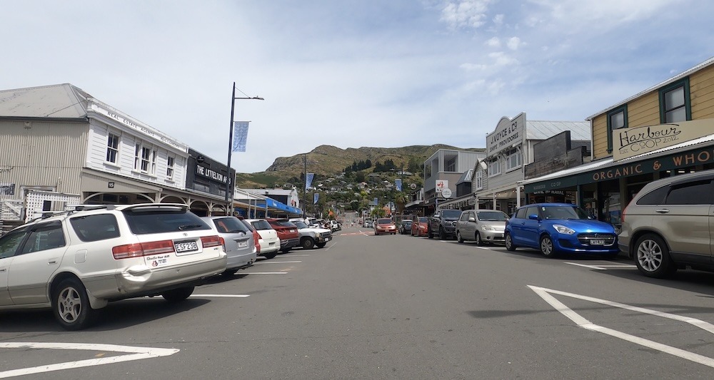
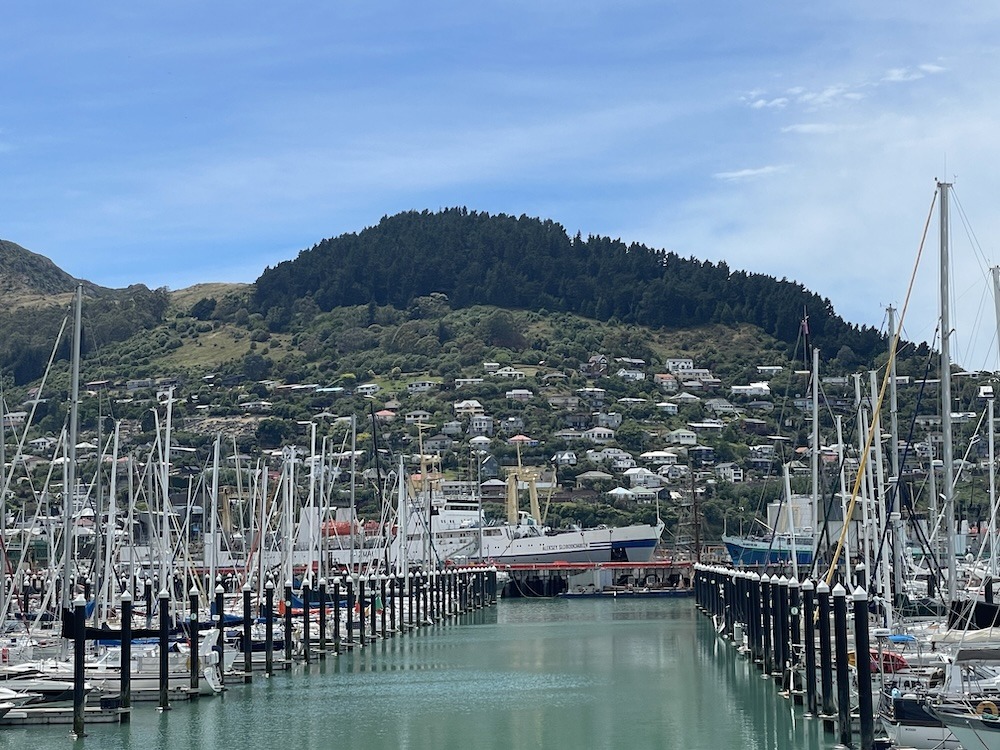
It only took a few minutes at these speeds to arrive in Lyttelton – Strava clocked me at 39 mph on this descent – it felt faster due to all the twists and turns! In Lyttelton there was a small main street where all the action was, with the homes built all the way up the hillside. The access roads to the homes are really steep so I’d have to see this place in winter to know how they can get home when its icy. There is a container port here and large fuel/oil storage tanks – a couple of container ships were in port at the time I rode through.
The marina was full of sailing boats. A guy I met explained that a lot of sailors bring their boats to New Zealand for the big maintenance work and refurbishment due to the lower prices for this work than in some other countries, like the USA. Most of the work is being done on the North Island up in Auckland, so most likely this marina’s sailboats were locals.
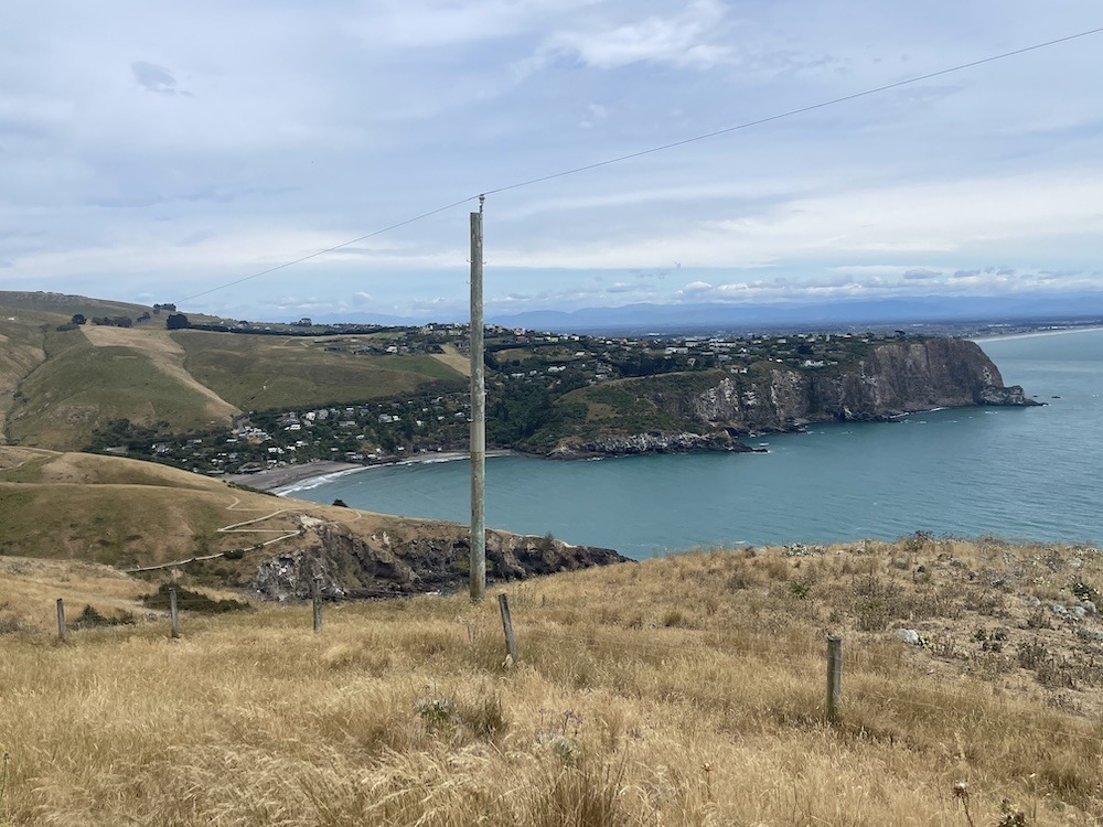
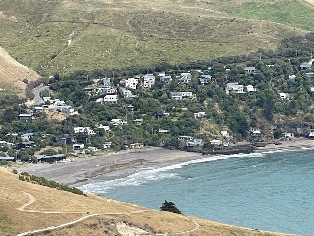
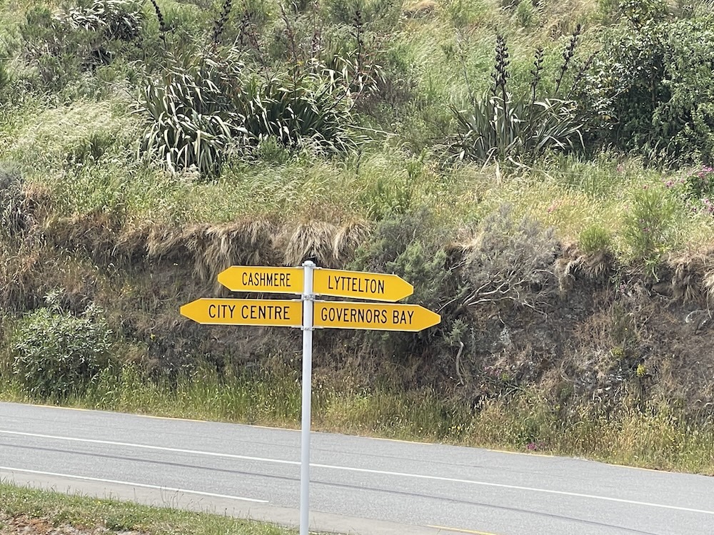
Heading west along Governors Bay Rd it’s relatively flat with some rolling hills. It’s a great road though and somewhat prone to accidents based on the warning signs along the road. Motorcycles are going fast through the twisty corners, some are quite sharp, especially if you are carrying some speed.
All good roads must come to an end, and after a few miles you reach a T-junction and you have to go either left “nice” or right “hard”.
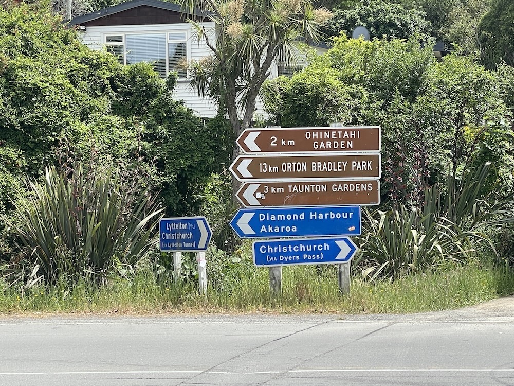
I had to return to Christchurch, so it was time to take a drink and plod up the hill one more time, but now from the other side of the mountain. The climb up to the Col de Dyers Pass seemed a lot harder in this direction, with the steeper gradients lasting longer. At one point I almost came to a stop – it was steep! Eventually you reach the top and pull off the road in a cafe parking lot (The Sign of the Kiwi) and see this sweet sign (below) – left or right, its a massive downhill either way – time to enjoy the fruits of my labor 🙂
After an uneventful high speed descent I rolled back to Christchurch on the familiar cycle paths and park trails to the hotel. This was the most exhausting ride so far, but it could just be the miles building up in the legs after 5 days in succession.
Tomorrow is move day – I checkout of the Doubletree Hotel and rent a car for the 6 hour drive to Queenstown when I have rented an AirBnB. Locals have already informed me that Queenstown is more expensive but the scenery is breath-taking. I have made some good memories and some new friends in Christchurch. These first 5 days of the adventure have been rewarding in several ways. I’m looking forward to the next 8 days in Queenstown.
Enjoy the gallery photos – click on them to open the full size image.
Gallery